Hot and humid weather continues for today
(WWAY) — Temperatures will be soaring into the middle 90s today as rain chances increase this weekend.
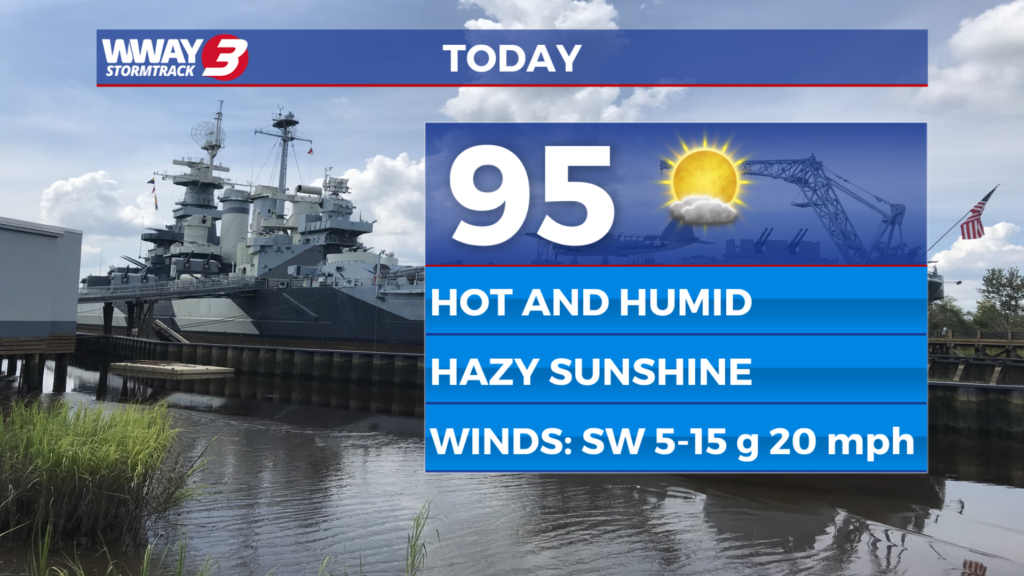
Look for hazy sunshine today with hot and humid highs in the lower to mid 90s and heat indices reaching around 100 in the afternoon. Friday will be hot and humid with highs in the mid to upper 90s and heat indices as high as 102-106 with a slight chance of an afternoon shower or thunderstorm under sunshine and scattered cloudiness. A cold front will approach the region this weekend and likely stall. The deeper moisture flowing in will combine with the front to bring a better chance of showers and thunderstorms Saturday with highs in the lower 90s. Sunshine and clouds and just isolated showers or thunderstorms are expected Sunday with a high around or a little over 90. With a couple of fronts in the vicinity early and middle portions of next week… our weather will remain unsettled with widely scattered to scattered daily showers and thunderstorms. Highs Monday and Next Tuesday will reach around or a little over 90… dropping into the upper 80s by next Wednesday. Rainfall amounts over the next 7 days could range from 3/4 inches to 1 and a half inches.
WWAY FORECAST:
Today: Hazy sunshine. Hot and humid high in the lower to mid 90s. Heat index values in the afternoon reaching around 100. Winds southwest at 10-15 mph.
Tonight: Mostly clear… warm and muggy. Low in the middle 70s.
Friday: Hot and humid. Sunshine and scattered clouds with a slight chance of an afternoon shower or thunderstorm. High in the mid to upper 90s. Heat index values in the afternoon reaching as high as 102-106.
Saturday: Partly cloudy skies with temperatures into the lower to middle 90s. Scattered showers in the afternoon.
-Meteorologist Jason Korver