WEATHER DISCUSSION AND FORECAST
04/4/2026
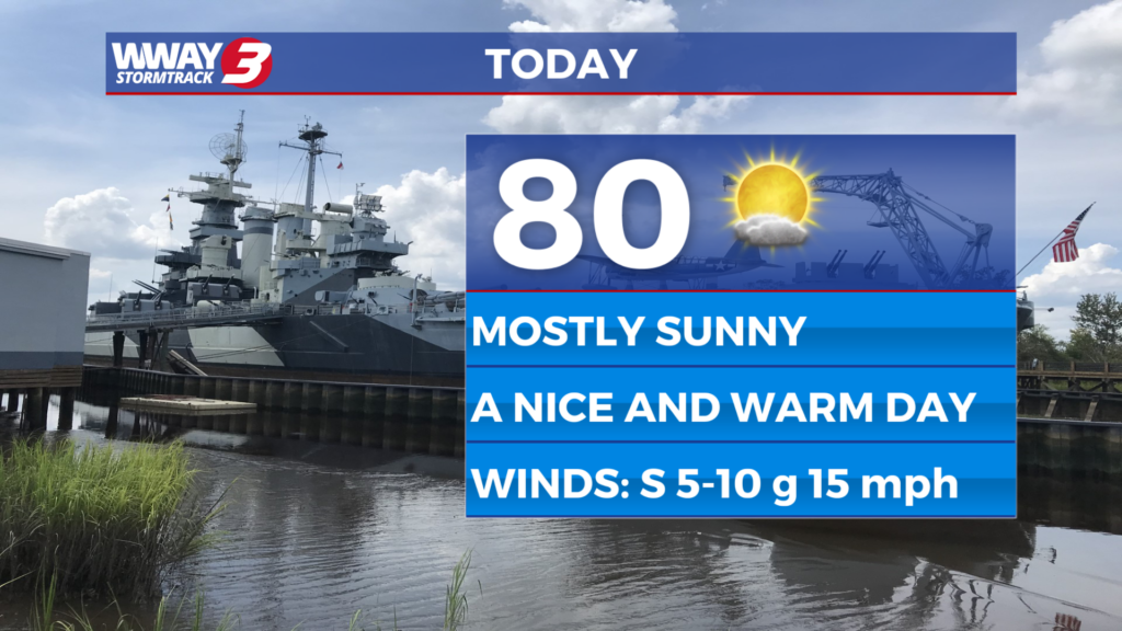
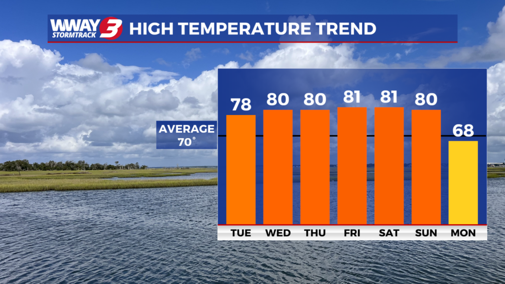
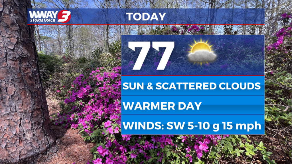
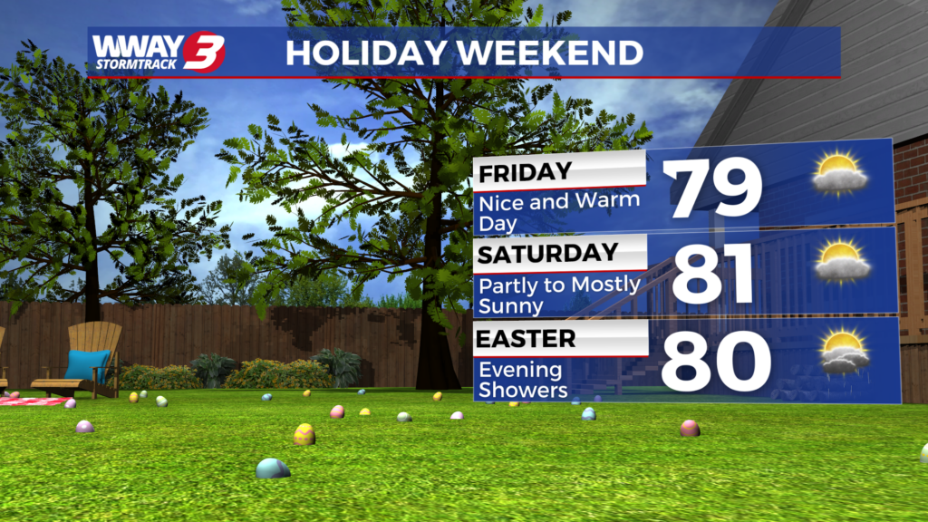
WEATHER DISCUSSION: Happy Saturday! Very little weather change is expected this afternoon with sunshine and scattered clouds and more nice and warm highs around or a little over 80. An isolated shower is possible mainly interior southeast North Carolina but most areas remain dry. Increasing rain chances are expected as we get into Easter Sunday and Sunday night as a cold front approaches the region. You may need the umbrella at times especially in the afternoon and into Sunday night when the highest rain chances develop. A few thunderstorms will be possible as well and there is a marginal risk of a strong or severe thunderstorms with the main risk being strong and gusty winds. Otherwise look for partly sunny skies Sunday with breezy winds and highs around 80. Behind the cold front Monday… dry weather returns with mostly cloudy skies lingering and cooler highs in the upper 60s to near 70. It will likely remain mostly cloudy Tuesday with near seasonable weather and a high again in the upper 60s to near 70. Strong high pressure from the north ridges down and into region next Wednesday bringing back mostly sunny skies with a cool high in the middle 60s. Overnight lows next Tuesday and Wednesday mornings will be in the cool 40s. With ongoing severe drought across much of the Cape Fear and continued mainly dry weather through Saturday and again for the bulk of next week… be very careful with flame and do not burn with a statewide North Carolina burn ban in place.
WWAY FORECAST:
Overnight: Mostly clear and mild. Low in the lower 60s.
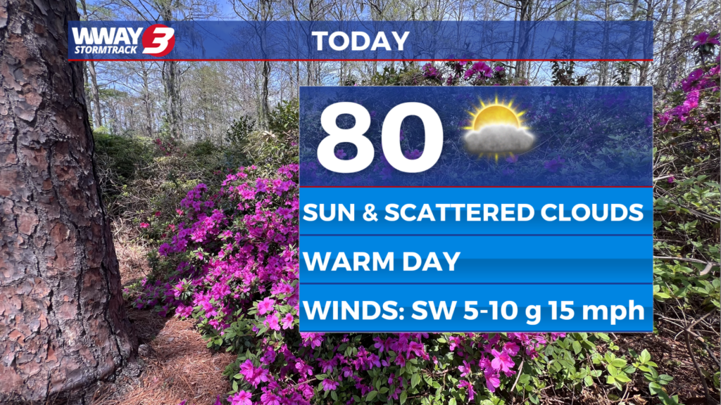
Easter Day (Sunday): Increasing cloudiness and breezy with scattered mainly afternoon showers and a chance of thunderstorms. Warm high around 80.
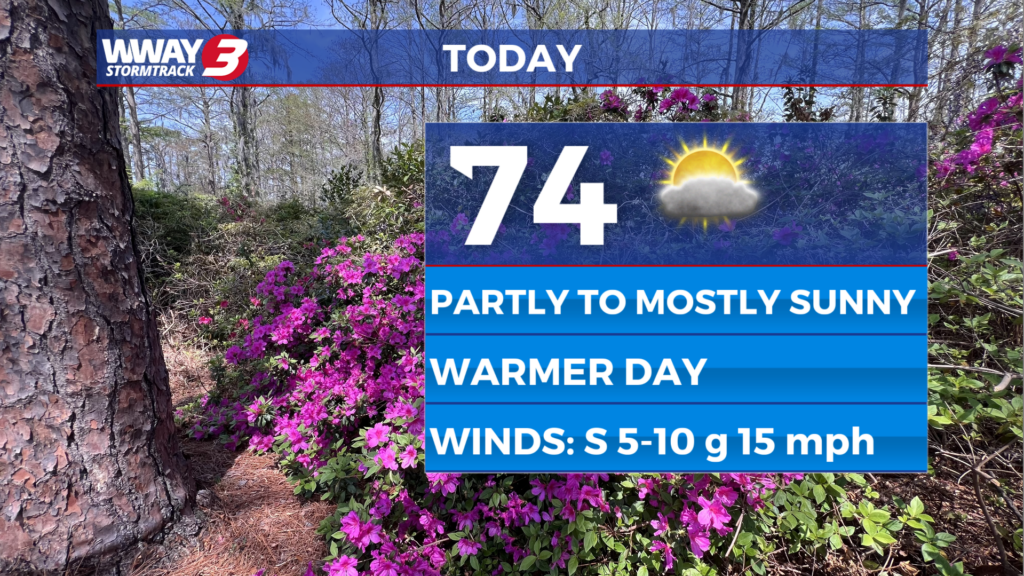
Monday: Mostly cloudy skies. High near 70.
-Meteorologist Charles McKeller
To view the full 7-day forecast, click HERE.
You can follow the StormTrack 3 weather team on social media!
Chief Meteorologist Lee Haywood: FACEBOOK – X (TWITTER)
Meteorologist Jason Korver: FACEBOOK – X (TWITTER)
Meteorologist Charles McKeller: FACEBOOK–X (TWITTER)
Keep track of the very latest StormTrack 3 forecasts and anytime severe weather threatens the area on Facebook and Twitter, and on-air by streaming us live!
Weather Maps

Local Temperatures

Current Winds

Regional Temps

Feels Like Temps

Local Radar

Carolinas Satellite/Radar

Southeast Satellite/Radar

Beach Forecast