WEATHER DISCUSSION AND FORECAST
7/16/2026
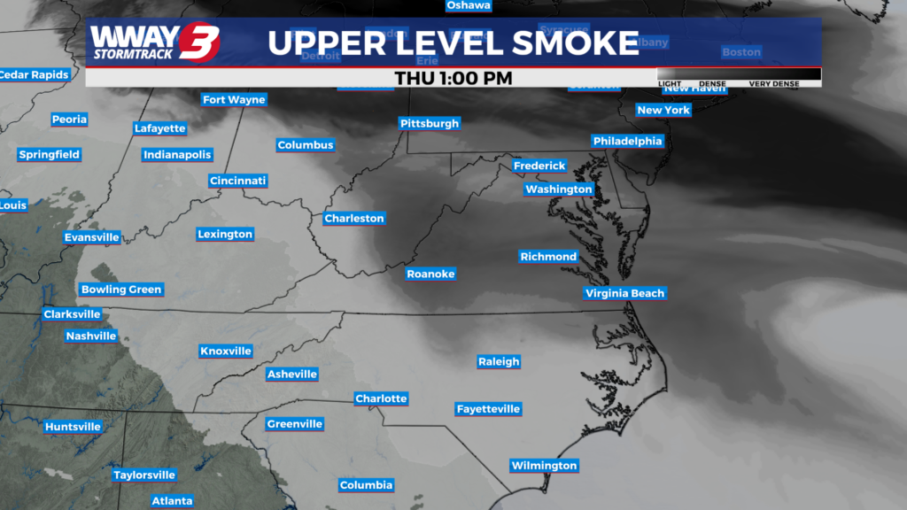
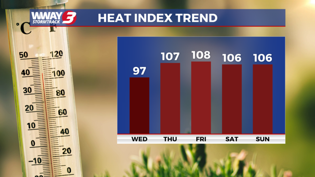
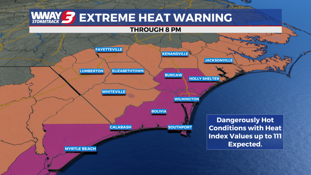
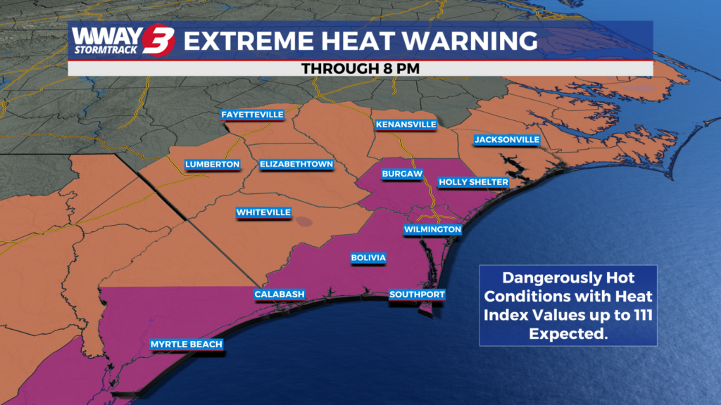
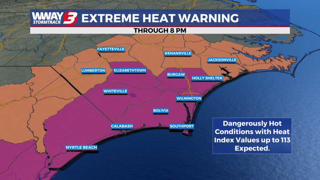
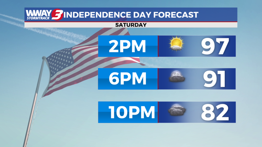
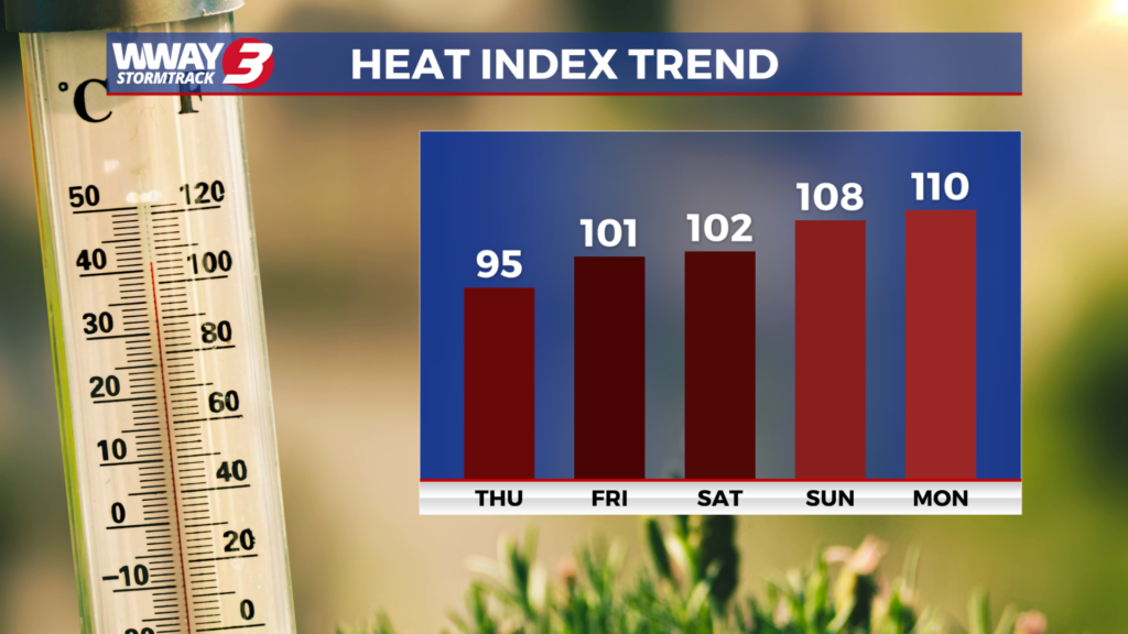
WEATHER DISCUSSION: Hazy sunshine is mixed with scattered cloudiness across the Cape Fear on this Thursday afternoon. The hazy skies are brought to us by high level smoke passing through from wildfire activity across Canada dropping southward. Temps are hot and humid with mid 90s inland to around 90 on the coast. Heat indices are running from 100 to 105. Hot high pressure is in control and will remain so tonight bringing just a few clouds otherwise warm and muggy lows in the upper 70s. The combination of a weakening front moving down along the southern Virginia/northern North Carolina border combined with surface troughing across the Carolinas will lead to perhaps a stray shower or thunderstorm Friday otherwise look for sunshine and a few clouds with hot and humid highs in the upper 90s and hot heat indices from 106-110 thanks for strong upper-level ridging. The combination of a trough across the Carolinas this weekend with increasing deeper layered moisture will lead to a little better chance of unsettled weather… mainly Sunday. Look for mostly sunny skies Saturday with hot and humid highs in the middle 90s. Sunday will bring a few showers or thunderstorms with highs staying hot and humid in the middle 90s. Any thunderstorms that develop this weekend have at least a marginal potential to be strong to severe with damaging wind gusts/straight line winds the primary concern. For the beginning of next week look for a low pressure which likely originates in the northeast Gulf to move inland and slowly across the Carolinas providing a little better chance of heavier showers and thunderstorms and hopefully some much needed rainfall for our ongoing drought. Highs dropping a couple of degrees Monday into the lower 90s will be followed by more heat next Tuesday reaching the middle 90s.
WWAY FORECAST:
Tonight: A few clouds. Warm and muggy low in the upper 70s. Winds southwest around 5 mph.
Friday: Abundant sunshine and a few clouds. A stay shower or thunderstorm is possible. Continued hot and humid with a high in the upper 90s. Heat index values in the afternoon from 106-110. Winds southwest becoming south at 5-15 mph.
Friday Night: Mostly clear… very warm and muggy. Low in the upper 70s to around 80.
Saturday: Mostly sunny… hot and humid with breezy southwest/south winds. High in the mid 90s. Heat index values in the afternoon reaching from 104-108.
-Chief Meteorologist Lee Haywood
To view the full 7-day forecast, click HERE.
You can follow the StormTrack 3 weather team on social media!
Chief Meteorologist Lee Haywood: FACEBOOK – X (TWITTER)
Meteorologist Jason Korver: FACEBOOK – X (TWITTER)
Meteorologist Charles McKeller: FACEBOOK–X (TWITTER)
Meteorologist Cicily Hammers: FACEBOOK – X (TWITTER)
Keep track of the very latest StormTrack 3 forecasts and anytime severe weather threatens the area on Facebook and Twitter, and on-air by streaming us live!
Weather Maps

Local Temperatures

Current Winds

Regional Temps

Feels Like Temps

Local Radar

Carolinas Satellite/Radar

Southeast Satellite/Radar

Beach Forecast